


Watching The Clouds: A Boating Guide
As boaters and outdoor enthusiasts, we diligently check weather updates before we go out, plan our days around possible stormy weather, and bring our radios and GPS systems on board to ensure a smooth trip. But no matter how prepared we are, getting out to the water and seeing an odd cloud formation can leave even the best navigator scratching his head. How do you use the clouds to your advantage, rather than let them shroud your day in uncertainty?
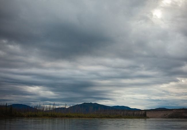
Get familiar with the clouds. They are the indicators of the changing sky, and might be the first to warn of an incoming storm or a rain-free day. For example, did you know that high, wispy cirrus clouds can often predict good weather—but the appearance of cirrostratus can mean a rainstorm by the end of the day?
Here’s a simple guide to knowing the different types of clouds, when they occur, and what they mean:
Cirrus (high clouds): Occur at altitudes above 18,000 feet
Alto (middle clouds): Occur at altitudes of 6,500 feet to 18,000 feet
Stratus (low clouds): Occur at altitudes below 6500 feet
These cloud groups are paired with cloud shapes:
Cumulus: Heaped or piled (an accumulation)
Stratus: Spread out or flattened
Nimbus: A rainy cloud
The prefix of a cloud group with the name of a cloud shape is used to name specific types of clouds. While it’s helpful to memorize these cloud types, as long as you can associate certain weather conditions with the look or makeup of a cloud, you should be fine.
Cirrus clouds: Watch the movement of this basic cloud type to know where weather is coming from. While the presence of cirrus clouds indicates fair weather, they can also predict weather changes within the day, so keep an eye out.
Cirrostratus clouds: These are thin and cover most of the sky. Cirrostratus usually predict a rain or snow storm within 12 to 24 hours.
Cirrocumulus clouds: Can be white or gray and are often seen in winter; they usually indicate fair, cold weather. If you’re in the tropics, they may signify a coming hurricane—but in this case you’ll have plenty of warning beforehand should a hurricane spoil your plans!
Altostratus clouds: Cover the sky (and makes the sun or moon appear hazy), usually precede rain or snow storms.
Altocumulus clouds: Fluffy, gray to white clouds with some parts darker than others; when seen in the morning (especially paired with heat and humidity), expect thunderstorms in the afternoon.
Stratus clouds: Gray, low-hanging clouds that cover a large area, and are often associated with light rain; they can form into storm-making nimbostratus.
Stratocumulus clouds: Gray and lumpy clouds that often form in “rows” against a blue sky. They don’t typically bring precipitation, but when part of a frontal system they may turn to nimbostratus.
Nimbostratus clouds: Dark, low clouds that give way to rain showers.
Cumulus clouds: Form vertically—on their own, they indicate fair weather. But throughout the day, as heat begins to rise, cumulus clouds continue to develop and form storm-producing cumulonimbus.
Cumulonimbus clouds: Have an “anvil” top and are stacked high in the sky; this type of cloud can produce strong thunderstorms, while the anvil points toward the direction the storm is moving.


Bookmark & Share
User Comments
Be the first to comment on this post below!
Previous Article
Next Article